
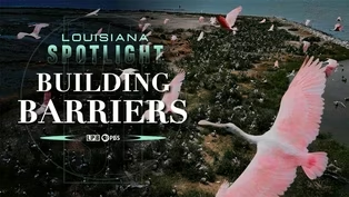
Building Barriers
Episode 14 | 56m 46sVideo has Closed Captions
Exploring the science, politics and people shaping the future of the state’s fragile coastline.
Exploring the science, politics and people shaping the future of the state’s fragile coastline.
Problems playing video? | Closed Captioning Feedback
Problems playing video? | Closed Captioning Feedback
Louisiana Spotlight is a local public television program presented by LPB
Building Barriers
Episode 14 | 56m 46sVideo has Closed Captions
Exploring the science, politics and people shaping the future of the state’s fragile coastline.
Problems playing video? | Closed Captioning Feedback
Where to Watch Louisiana Spotlight
Louisiana Spotlight is available to stream on pbs.org and the PBS app.
Providing Support for PBS.org
Learn Moreabout PBS online sponsorshipFor decades, the has grappled with its disappearing coast, arguing over how best to restore it.
Since the early 2000, the Coastal Protection and Restoration Authorities main strategy has been to reconnect the Mississippi River to the Gulf through man made diversions.
The day it opened up, it wasn't anything, and after that, everything changed.
The CPR invested billions of dollars in funding into this diversion strategy.
Yet in 2025, after public outcry and a new governor, every one of those plans were canceled, money was lost, and the organization pivoted.
Now it has shifted back to the preservation of the state's barrier islands.
I'm your host, Oscar Tickell.
Thank you so much, John.
I traveled across the coast by land, water and air.
You ready to find out what happened, where the funding went and what happens next for Louisiana?
What do we do without these major river we connections that were part of the plan?
Is it time to actually maybe think about what we do for the next hundred years?
This is the first time we're actually going to be able to do a restoration project on the chandelier.
This is building barriers.
For years, the CRA has made attempts to create fresh water diversions across the tail of the Mississippi in Caernarvon, Davis Pond and the Bohemia Spillway.
Hundreds of millions of dollars were spent from the get go.
The diversions caused controversy.
Scientists insisted they were the most effective way of restoring land, while the people living around them complained about fresh water, changing the saltwater landscape and destroying fishing industries.
When the CRA released its Coastal Master plan in 2023, detailing a $2.9 billion river reconnection, discord reached its peak.
That project was the sediment diversion, and it plans to use everything the agency had learned to create a channel that would release 5.5 million tons of sediment a year, making 5000 acres of wetlands in ten years, in 17,000 acres in 30 years.
In 2023, under the administration of Governor John Bel Edwards.
NIB Eritrea gained approval and full funding.
Not investing in coastal restoration and protection simply is not an option.
But just two years later, Governor Jeff Landry canceled the project altogether, citing it was no longer financially viable.
I mean, if we stopped the project, we're going to lose 500 million.
It may cost us an additional billion.
Nobody can tell us.
Heated debate spark yet again.
There's nothing experimental about this.
You were a complete, uninformed third time idiot.
If you think that's the case and forgot to use the word idiot.
Garrison, never come sit down with me.
Did you come sit down with me and look at all the facts of figures?
I would love to.
I would love, and then let's go.
All right, let's rodeo anytime.
It's obvious this was being rammed down I throat.
And they keep saying, well, the experts say, well, the experts at say are the experts that made money off it, but to totally abandon the project.
I don't think that it really is taking into consideration legal consequences, financial consequences, and most importantly, what it's going to do to the state when doing research for the area, sediment diversion and other planned diversions like it, the CRA used existing diversions as case studies.
One of those diversions was the money group has a natural diversion that the river carved out of an existing water control structure in 2011.
My team and I traveled to point out a hash, one of the towns most affected by the influx of fresh water.
We are going to go to the Mardi Gras Pass, one of the most impactful diversions of the Mississippi River.
I completely changed point a hash from a thriving fishing town to a fresh water closed in area that no one can even get out into the Gulf from.
My family and I have a camp about five minutes from Beccles Marina.
When I was a kid, my mom, dad and uncle would ride on the road, in the mud and along the river.
I barely recognized it.
As we arrived at Marina and met up with the owner, Don Beckel.
How you been?
And good, good.
This is Darryl.
Hey, Darryl, how are you doing?
And we found out why Pournelle has turned from a fishing town to a research site.
Bachelor boat launch opened up in May of 1972, and that's when the Marina actually opened up.
It was all saltwater at that time.
And of course, plenty fishermen, plenty of oysters.
So.
And the oil companies were prevalent.
They were all over the place.
We actually catered to three different industries, and it was very good.
It lasted a long time, but of course we grew and other diversions were open, and we even grew bigger because the fresh water had gone towards their area, which pushed their boats to us all over Louisiana.
They came here.
You could almost walk across a boat to vote to boat, and they had a little opening down the middle, and they were all waiting to get unloaded up there about a public dock.
And of course, I put a couple of conveyors back here to help, you know, help to process it and make money.
When you would leave here to go out fishing, it was marsh grass and at the marsh grass was pretty high.
It was three feet maybe sometimes for younger ones were smaller, of course.
And, you know, it was it was plush everywhere.
You'd go out and the buyers will all deep and nice and and they didn't change much at all for years and years now, you always had erosion and spots to where, you know, something would open up here or there.
That just just was like that.
They brought in a lot of fish, a lot of trout, and people came from all around to come here.
Of course, the marsh was so much healthier when you pulled up to the bank.
It was two feet above the water, and you'd have to sometimes climb up to get on to the land.
There was a lot of fish in this area.
The catch is back then, or almost unlimited.
When we first opened, it had its ups and downs.
Sometimes tours with a waste of Mecca.
Really.
Down here, downriver from the Marina was a water control structure that previously controlled flow from the river to the Bohemia spillway.
The structure was Louisiana's first real attempt at reconnecting the river in the march in 1926.
It once function to allow a pulse of fresh water into the ecosystem.
It was a fresh water diversion, and that's all we thought about it, and they opened it.
Every once in a while.
We would have fresh water in the Marina here.
When they opened it and it was in the springtime, it was a fresh water diversion to keep all the snails from eating all the way out there.
So you kept the salinity down so they could open at a certain time and close it a certain time points to what he describes as his turning point.
With the opening of the Monte Gras Pass in 2011.
That year, high river levels placed pressure on the system, causing a breach that continued to worsen in the years that followed.
The day it opened up, it was just a trickle.
It wasn't anything, and we all looked at it like it was nothing.
And I remember it opened up a little bit more.
Of course, we're thinking it's temporary.
It's not going to be here forever.
And you go down there and look, it wasn't that deep, wasn't that bad.
It didn't really change a whole lot because it came up, went down and natural cycles of the river.
We didn't have this, the silt that filled in everything as yet, but as years just built it up, built it up.
Then we started to notice a big change.
And and that's when all the, the marsh flipped from salt to fresh and you could see it.
I remember looking back here and it was just total mud.
All you could think in your mind is how much land is disappearing, how much land is disappearing.
To show us what he meant, Beckel took us out to see the pass.
Piloting the boat was Captain Chris Danaus and with a special son, William and coastal scientist Alicia Renfro with the National Wildlife Federation.
We're heading out the marine and we're going to go south, and we're going to Mardi Gras Pass right now, see the the changes along the way.
And then when we get the money Gras pass, you'll see the flow because the river is kind of high right now.
So first thing that you notice when when the water did come in with the lilies and that was bad in its own because we never had any lilies back here, never had to worry about lilies because we had so much salt water.
The grass grew back up in the marsh, but it was all fresh water.
Grass.
It was beautiful.
Don't get me wrong, out in the more vulnerable parts of the bayou was the smaller pieces of land.
A little land in front of other land that you used to fish by.
It went to mud and some grass grew on it.
But over a year or two gone.
The other thing that the fresh water, which we saw happening right before eyes, we started seeing willow trees, which you see only you know where water is, like on the batch of the Mississippi River.
And they started growing all along the canal here.
And people would say, look, it's working, it's working.
But the willow trees just represented something that just wasn't natural to the bayou.
People would look at the Martian.
It was people that were looking at the experiment happen, and they were all giddy and happy about it and not knowing all the bad parts about it.
Bishop told us that the willow trees brought in by the past only looked good on the surface.
He claims that they don't do a good job of holding land together.
It's almost like playing dominoes.
After this one falls, the next one falls and the next one falls.
I mean, I imagine four feet of water, three feet of water all over out here with no land.
That's what I imagine, you know, 50 years from now, except right along the edge here with the willow trees.
But the trees weren't the only thing the fresh water brought.
One bad thing, though.
We got the hogs now, and they started destroying everything.
And they'll go to a spot and they'll start eating the roots and everything.
It just mud and then it never comes back, becomes a little pond.
But it came with the fresh water.
They didn't have holds before.
We didn't have alligators here before.
Something that you mentioned to me before is that the water in your Marina used to go up and down with the tide, and now it falls with the river stages.
Yes.
That's it.
We don't have a tide here per se, anymore.
Yeah, it's just the river flow.
It's either in or out.
And with the changes in water came changes in catch an entire generation of the spillways.
Oysters were unable to sustain themselves due to the change in salinity.
Anything that could move shrimp, fish and even birds ventured out into the gulf with the salt water.
I mean, I could go out there and I used to catch bait shrimp 100ft from here.
I dropped the troll and go few feet and catch all I needed for the weekend.
That's how it was.
And when it ended, when it got really bad.
And I'd have to go out two miles and then have to travel in through fresh water, and half of my catch would die because I couldn't keep him at it.
As it became year after year, that's when the bayous changed and you couldn't go here and you couldn't go there, and and all the waterways changed.
The the cycles of the fish changed, and and people stopped coming before we got to the past, Beckel showed us plots of old growth that had died off.
It only took probably the year that we had so much water.
It took that one year to kill every tree here.
I mean, it was old growth.
I'm talking, you know, two 300 year old oak trees just couldn't take it anymore.
It was really, really strong and everything was wide open.
You could just go just about anywhere because it's been there for so long.
This whole area.
And now all you have is, you know, it's these trash trees, but they're trees.
Finally, we got the money.
Gras pass.
Over the past decade, I've been back to this same spot, tracking the changes.
Riding down the pass, we got a glimpse of what was left of that controlled water structure that overflowed.
We also got to see what was left of the road that ran next to it.
Growing up, my parents rode around this exact area.
This is the kind of land growth that manmade diversions across southeast Louisiana are looking to achieve.
Most of these diversions don't have a constant flow like the Monte Gras Pass.
And for years it was one of the only uncontrolled reconnection.
That is until Neptune Pass opened up further down the river in Empire.
We talked to Alicia Renfro about this.
She stated that the Neptune Pass started out similar to pass.
We've had these really high river events like the 2019 flood, and that's where you had Neptune Pass, which was a very small channel, blow up to a much larger channel.
The Corps had rocked it and controlled it in some ways, but that is like failing over time with some of these big floods.
Today, Monica, past this flow is at 20,000 cubic feet per second and Neptune is at 120,000, making it one of the most viewed and studied diversions.
So for a long time, there's been a lot of effort to do coastal restoration in Louisiana.
We recognized that we had a coastal land loss crisis, and sediment diversions have been the thing that's kind of been in the imagination for a really long time of the river is what built the coastal Louisiana landscape.
The river is a key to helping restore that.
So we've long recognized that cutting off the river from the adjacent wetlands completely has has changed the landscape.
And now when we talk about sediment diversions, we're talking about a system that we changed a long time ago.
And that will cause another shift as you're getting fresh water from the river back into these basins, it is going to change things.
But now we're almost 100 years after the 1927 flood, and we've managed the river for in the way it currently is managed for a really long time.
Is it time to actually maybe think about what we do for the next 100 years?
Because unfortunately here in Louisiana, we can't not do restoration.
It is about figuring out how we work together to do restoration that counts.
That's on the scale that actually meets the land loss crisis that we have.
The river is a key to helping restore that.
Getting that sediment and fresh water from the Mississippi River flowing back into the coastal wetlands, if not necessarily in the location that we would pick.
If you're trying to maximize sediment getting into the basin, it's not a controlled structure that you can open and close to maximize that sediment capture when the river is running high and carrying a lot of sediment.
But it's an example of what we can learn from what the river does.
Using the data collected from Neptune and Mardi Gras pass plans started being put into place for the Barataria Diversion on the other side of the river from Born in Ironton.
Hopes were high among the scientific community for what the project could accomplish.
I think there are legitimate concerns, and then there are concerns that have just been kind of overblown, but I think having those conversations is really important to try and figure out how we actually move forward together on coastal restoration.
So it's disappointing to see us shift away from that.
There are legitimate concerns around diversions around that freshening.
There was money involved in the Mid Barataria sediment diversion that would have helped with some of those transitions, getting people who like if you have to move Easters, that sort of thing, or transition some of the fishermen.
But it's also a controlled structure that could be adapted so that we can maximize the amount of land built, but also minimize the impact.
So it's disappointing to see us kind of walk away from a project that we've spent so much time, energy, and that really kind of held the key to using the Mississippi River once again to restore our coast.
So we are about to go to Myrtle Grove, where they were planning on doing the Mid Barataria sediment diversion.
When you heard about that.
What were your thoughts?
The poor people are not going to have any any more fishing any more behind them.
They're not going to have any land left back there because their land has disappeared already.
Many questions about the project still remain for us, so we scheduled to meet up with some old Miller's campaign director for Restore the Mississippi River Delta at Myrtle Grove Marina across the river.
We wanted to ask her what the plans were, where the funding came from and where it went.
So we told will be.
Thank you so much, John.
No problem.
Anytime.
And we hopped on the ferry.
The east bank of the Mississippi is doing significantly worse than the West.
Most diversions are on the other side, leaving the Myrtle Grove area to experience significantly more land loss.
Man made river connections aren't just put anywhere.
Years of research goes into them.
An area of the river that would provide the most amount of sediment output is picked.
Then more time goes into hiring a company to conduct an environmental impact survey, not to mention the funding talks that come after we met with similar laws down the road from the former construction site.
Hey, nice to meet you.
Nice to meet you.
And we walked up on the levee to ask what happened to the diversion plans.
So we're kind of in the heart of the Barataria Basin.
We're a little bit to the side that is obviously a lot closer to the river.
Right over that levee right there.
Just up the road here would have been the site of a mid sediment diversion.
There would have been a channel that connected the river with a series of gates, and it would have connected it more into the heart of the basin, where it would have delivered that freshwater and sediment.
She explained to us her job with restore.
We are a coalition of four different nonprofit National Audubon Society, National Wildlife Federation, Environmental Defense Fund, and then we have the Louisiana based organization Pontchartrain Conservancy.
And then, of course, we know our world here changed in August with her Katrina and then a month following with her at King Rita.
So all those coastal rules Scott rewritten.
One of the things that came out of that was a coastal master plan, and the fact that we needed this one guiding document.
And so our first master plan came out in 2007.
So I've been involved in one way or another in that planning process since 2007, but really been part of like an advisory team, a structured team of folks that kind of look at the plan all throughout its six years to make sure that they're tracking its progress before it gets to the legislature, where it gives an up or down approval.
And so really, the coastal master plan is so great because it is based in science, but it includes all those different tools in the tool chest.
It is not just one silver bullet solution for the entire coast.
So levees like the one that we're standing on right here provides immediate protection in case of a storm.
Right.
But then what you need is you need something in front of that levee.
You need to protect that protection so that this levee, this structural, this immediate protection isn't vulnerable.
So we call that that multiple lines of defense.
So in the last master plan, diversions were considered in a future without action.
And that can seem like a very confusing term.
But what that meant is that they had already put those diversions on the landscape, assume that they were going to be starting to be built, and these other projects would come along and complement that.
Malaise drove us down the road to the former site of the diversion.
So we're leaving the murder of community right now.
We're going to head back out to the four lane highway 23.
That's a major artery that takes you down to Venice, but we're going to go up back towards Bellechasse, and we're going to drive by the construction site just off the road.
The presence of the pre version construction lingers.
We pulled over and put the drone in the air.
Updated.
So what am I looking at here.
Yeah that I mean you can see that's the that's like would have been the connection to the river right there.
They would have had a huge, huge gated structure there.
Miller's was able to help us visualize what the project would have looked like.
The diversion would have had a shovel shaped mouth at its riverside entrance, funneling in water with a gated structure followed by a two mile long culvert.
The basin side would have had a similar opening.
The gated structure is what sets it apart from Monte Gras and Neptune Pass, making it fully controlled with possible diversions like the diversion.
They were talking about there being a minimum flow, right?
So even when it was closed, there would still be some flow.
So for all different projects, even those Davis Pond and Caernarvon projects, there are minimum flows that are always part of the operation.
That's considered.
Right.
So for Davis Pond it's a thousand cfs.
And so they were actually thinking about the same kind of controls for Mid Barataria.
One thing that's really, really important to remember is that if you had something major happen along the river, let's, let's say you had a spill or something on the river, you could absolutely close those gates and you didn't have to worry about what a minimum flow is compared to Mardi Gras Pass.
The flow rate was planned to be twice as much at 75,000 cubic feet per second.
Not as much as Neptune Pass, but plenty to bring in sediment.
Construction was so far along in the process that $560 million had already been spent on permitting and clearing the property.
Entergy bucket trucks are still around, and there's even a parking lot.
So what happened?
So we were already under construction.
There was already a guaranteed maximum price bid contract in place.
There were 100 different subcontractors that were part of this very big contract that was already doing work on the Barataria side here.
We had a groundbreaking in in August, and then a new administration came in the following year.
They wanted to hit pause on the further construction.
They wanted to look into what they said.
They wanted to look into the project a little bit more.
And that was the very first thing that happened.
That started ultimately an extremely long delay and ultimately ended up with a cancellation.
There were lots of things that happened politically along the way, including discussions with the Army Corps of Engineers about the permitting process, some discussions about some modeling that was used, etc.
but at the end of the day, the project received a cancellation and they no longer are working on that project.
After nearly $700 million had been spent on both this project and the project on the other side of the river.
And that's important, because that money came as a result of Deepwater Horizon oil spill tragedy.
Of course, that happened here in 2010.
The Deepwater Horizon oil spill happened after a blowout of BP's Macondo oil well in the Gulf.
Oil from the spill impacted most of the Gulf Coast, coating animals, killing sea life and choking vegetation.
As a result, the legislation has deemed BP give $7.29 billion in damages to be used for coastal projects through 2031.
The CRA is the main trustee of this money through the Louisiana Trustee Implementation Group, or Tig.
The silver lining of that, unfortunately, is that that is some of the major restoration money that we have right now that we're trying to put into play here and invest in coastal Louisiana.
It was fully funded.
I think that's a common discussion out there, a common point, but it was fully funded to the point there was a guaranteeing back from the contract that was in place.
There were things like operations and maintenance, and that's part of any coastal project.
So the things that have affected the Barataria project, including cost escalations, etc., are no different than than a levee project or other coastal projects that are happening right there, including barrier islands, etc.
things just cost a lot more money, except we have less time and we could have less resources available.
Now what?
What's next?
What happens to that money?
And more importantly, how long will it take to be able to put some real solutions on the ground?
And so that's where we are right now.
The money not used on existing construction and permitting, is going back into the Deepwater Horizon fund to be reallocated into projects in the same category.
Miller's also mentioned that there are talks about already spent Middlebury funds having to be repaid.
What do we do without these major river reconnection that were part of the coastal master plan?
What do we do with that money we have that's meant to invest in coastal Louisiana?
And how do we think about that important tenant of the master plan, which is reconnecting to the river?
How long will it take and how much money will it cost?
The fact of the matter is, is the land that we're standing on, and the place that we live right now is changing every day with and without us.
And so what we have to do, what we want to do, is be a part of that solution.
How can we talk about what a future here in coastal Louisiana looks like?
Because it is changing.
Changing with or without us.
Now the diversions are canceled.
The CRA is going back to doing what it knows how to do restoring Louisiana's barrier islands Louisiana has 20 to 25 barrier islands and headlands across its southern border, made by sediment buildups hundreds of years ago.
So barrier islands.
A couple of years ago, they decided to make a shift into something that they call programmatic.
And what that means is you slide into another category where you're doing the same thing over and over again, and the barrier islands are just like that.
That is something as our first line of defense, you know, it erodes, it takes the brunt of some of that golf force.
And so that's something that we have to go back to over and over again to make sure that we're holding that first line of defense.
We know how to do it pretty well, but it's something that we have to keep up with time.
And with that, we told malaise goodbye, and we were off to one of Louisiana's barrier islands.
The CRA releases its coastal master plan every six years.
But that's not the only plan it publishes.
The Barrier Islands Report is released every year, and it claims that the CRA has restored almost all the barrier islands in headlands in Louisiana.
It lists every barrier island ever worked on, whether it's being worked on now and possible plans for the future.
There are currently 40 projects in the 2027 plan, Grand Isle being one of them.
Grand Isle is probably the most famous barrier island in Louisiana, the only active one left, meaning that people still live there.
Historically, it's made appearances in novels featuring Louisiana, like Kate Chopin's The Awakening.
So much work has been done on the island over the past decade, including breakwaters and beach nourishment, that it is one of the only islands listed in the Barrier Islands report with no future projects.
But one of the other islands stands out not just because of the name, but because of the amount of work going into it.
Raccoon Island I got in contact with John Wiebe, Louisiana restoration and program manager for the Louisiana Department of Wildlife and Fisheries, and we set a date to tour the island.
The plan was to meet we be at Louisiana Universities Marine Consortium, or Lum Con in Coquetry, get on a boat and ride around an hour south until we hit Raccoon Island.
We pulled into Lum Con, put it on our like best, and met the rest of the team for the day.
John Wiebe, who organized the trip.
Robert Dobbs, ornithologist with and our captain Tyson Crouch, land manager of Raccoon Island.
We're departing from Long con and Kokoda.
Soon to hit the F Canal, and only briefly.
And then we will take a shortcut around or through some bays, see some oyster leases, and stay north of Trinity Island and cut through Whiskey Pass and all the way west to raccoon.
So up here, a little more north before we get into more open water.
The marsh is still reasonably healthy in places, and as we head out more southerly, you'll you'll notice that the marsh degrades pretty quickly.
We made our way down into the Gulf, passing islands in the chain on the way down like whiskey and Trinity Island.
The waves were pretty rough.
But as we started to pull up to the island, the sky cleared and the sun came out, making it apparent what was so special about Raccoon Island.
It's a nesting ground.
Good number of grits nesting in among the pelicans.
Single great blue heron that appears to be nesting, which not many great blues nest out here.
I was happy to see the colony of about 60 Caspian turns.
They've only started nesting out here in the last handful of years.
We're sort of looking down the the north side, the bay side of the island.
Pretty dense brown pelican breeding colony.
A lot of these birds have older chicks.
It's early May as well as a scattered groups of nesting Grady grits, tricolored herons, reddish egrets, black crowned nine herons, brown pelicans, royal turn sandwich turns.
Their island obligate breeders.
They rely on these remote barrier islands, which generally are free from predators, which is one of the primary limiting factors for these birds.
We think about these islands as as breeding colonies, rookeries, and rightfully so.
But they do provide critical resources for birds that only may use these these habitats, you know, a week of the year.
So we want to do a thorough of a survey as we can.
So ideally we'd, you know, cover the entire island by foot, avoiding situations where we would disturb the breeding birds, right, sample all the habitats and count and identify all the birds that we find.
Right.
And so do this periodically.
And, you know, over time, build the picture up of how the birds use this island at different seasons.
A lot of these birds, particularly the pelicans, are very final.
Patrick, they want to come back to the same nesting area year after year.
And so yeah, if they came to this spot and it was it was flooded, they'd probably they'd probably try to wait it out.
The island is home to many unique species, but in 2025 there were reportedly flamingos spotted.
Explaining the birds and the island's function to us.
Doves walked us around, so we're currently walking on a marsh platform.
Was part of a restoration project implemented in 2013.
Small birds, Lambert's like martins, warblers, cuckoos do.
What's called trans Gulf migration migrate from the Yucatan across the Gulf.
And this is the first land that they that they, you know, see when they arrived.
So, you know, one of the main benefits of doing a ground survey is to survey things like solitary nesting shorebirds like Wilson's plover, Willets, things that are not captured by that, that aerial photography as well as non-breeding shorebirds like we talked about before.
So pelicans will wrap up breeding, you know, July, August.
Occasionally you'll get some some late nesters that go into the end of August, maybe the very first part of September.
But for the most part, they're they're wrapping up, you know, mid-summer.
There's just so many.
Yeah.
So the main way, the primary way that we survey these colonial birds like pelicans and turns is via aerial photography.
And so from a fixed wing aircraft basically use high resolution, still image photography to document the entire colony.
Right.
And then those images are stitched together, mosaic together.
It's all geo referenced.
The white elegans you're seeing are only a few months old and their pouches aren't flapping in the wind.
They're doing that on purpose to cool down.
After staring at the birds for an hour or so, we did an interview with Wiebe.
We asked him about the history of Raccoon Island.
So Trinity whiskey and raccoon today are individual islands.
But you know, back in the day, it was all one island together.
In fact, when you can still see a lot of the residual pilings and what have you, there was, folks, this was a vacationing area for a lot of folks that lived in the state.
And and then gradually over time, it's now become what it is with being ill and ears wildlife Refuge starting in 1990, a lot of the projects began as demonstration.
And we'll see on the Gulf side where you see the breakwater field, obviously, a lot of the habitats that we're encountering throughout our coastline are going through significant erosion, subsidence and what have you.
So that Breakwater Fields is a demonstration project was allowed to have a way to knock down those waves for you and, and figure out ways that we could reduce the energy and thus the impact.
Why is it called raccoon?
I would recommend like the idea of Raccoon Island.
I really don't know the answer to that question.
In fact, I run into this a lot with some of my projects.
One in particular, Rabbit Island, located in Calcasieu, and I talked to folks multi-generational in the area, and none of them have given me a good answer as far as as concerned.
But we'll keep looking into that.
And if we figure that out, we'll get back with you.
So we're standing here and we're on one of the most productive colonial waterbird islands in the northern Gulf.
And the reason why it was selected by these birds is still a mystery.
The thing that we have to do is we have to look at each one of these islands as unique, unique situations.
And how we have addressed this going, going forward has been get a solid understanding of how the birds are utilizing these habitats.
Well.
And so we took all of that in mind towards prioritizing the types of things that we would want in this restoration.
And some of these things will be realized that day one, as far as the acreage itself and the protection thereof.
But a lot of this as far as benefits are going to be realized over time.
That brought up the topic of funding.
Noah is the project manager for raccoon, and in doing so, we had to, you know, look at the types of resources that we wanted.
Balance.
Because ultimately, raccoon is designed to be a multi resource benefit project through the Louisiana Trustee Implementation Group, which consists of our federal partners as well as state partners.
And there's no way possible that we're able to get anything like this done without active engagement with our with our stakeholders.
And so from that, we have a solid understanding of the principal layout of what this island is going to look like.
And in total we're going to have 340 acres.
So that is based off the existing 81 acres that we have here on the island, as well as in addition to things like dune features and beach features, as well as the marsh that we were talking about earlier, one of the main methods to bolster the island and create new land is through offshore dredging.
About 9 to 10 miles off the coast of raccoon, a dredging station will dig up sand from the ocean floor and pump it through tubes back to the island.
The spot used for sand is predetermined to not cause any environmental interference or add to wave production.
This is what the CRA strategy entails.
Now.
No more man made diversions pumping sediment for the time being.
For now, the plan is to take buildups of sand from the ocean floor and repurpose it in a way that sustains land.
We're going to be doing some refurbishment, as we call it.
So adding another stone on the Gulf side breakwaters, right?
But will be installing on the Bay side is going to be bayside shoreline protection.
Typically for these types of projects, it's a 20 year lifespan, but with dollars that we have built in for operations and maintenance, we're hoping that we can extend that well beyond the project date for future projects.
For us, we just recently completed the terrible and HNC project or home and navigational canal.
That's 34 acres for birds, very similar to what you see out here in raccoon.
As far as your pelicans, your goals, returns, what have you.
And now we're at the point for this island we just passed.
As far as markers or milestones, 60% of Design Agency Island was described to us as an island further north that was made around a few patches of grass.
The island has been gaining nesting birds since its creation.
On the way there, we passed up a dredging boat and we were told it was pretty much what was going to be used for Raccoon Islands restoration.
Later, we pulled up to H and see Island.
And with that we came to the end of our trip.
We may have been leaving, but we already knew where we were going next.
When we were on Raccoon Island, we talked to Robert Dobbs about another island chain.
We plan on going to Schindler.
It's huge compared to this, and it's a fraction of what it was ten years ago, 20 years ago, just like this island is.
But it's it's got basically the same features but on a larger scale.
Right.
So it has it has mangroves, it has marsh, it has shell berms and it has extensive sandy spits.
It can accommodate many more birds, more breeding birds.
There's simply more more space, more area, more non-breeding birds.
The habitat is more extensive, but it's very much like this island in the sense that they're both really isolated islands, really remote, free from, for the most part, direct human interaction.
So folks aren't coming out here and playing volleyball in the beach and disturbing the birds.
In that sense, Schindler is unique in that it is simultaneously the farthest barrier island from mainland Louisiana, but also the biggest measuring 14 miles in length.
The island got its name in the 1700s, when French explorer Pierre de Iberville discovered them on feed de la chandelier, or Candlemas.
It was declared a National Wildlife Refuge by President Theodore Roosevelt, the same president who founded the national Parks system.
Chandelier was the only wildlife refuge he actually set foot on.
After decades of extensive hurricane damage, the island broke into segments.
Now, most people called the island islands instead.
Chandelier is the only barrier island that protects the New Orleans area a few months out of the year.
The island is home to species you can't find in mainland Louisiana.
Sea turtles nest here, and the island even has its own bird, the chandelier.
Golf.
We reached out to Todd Baker, projects manager for the CRA, and talked about what it would take to get to the island for a shoot.
Then we got this email from Baker.
This is not Raccoon Island unless we get really lucky.
This is far more strenuous than Raccoon Island, and he told us that we would need a pair of water shoes, a backpack with lunch and water bottles, sunblock, bug spray, the works.
The plan was that we would meet Baker and his crew in Bill Chase at Southern Seaplanes, get on a seaplane, fly 70 miles or 30 minutes, and circle the island to find a place to land.
We woke up at about 530 that morning, made our way to Southern Sea Plains and met our crew, Matt Weigel, biologist director for L.W.
Carey Lejeune, state herpetologist, CRA project manager Todd Baker, and our Captain Michael chef.
In no time we were flying to chandelier.
Everyone else on the plane was there to conduct a sea turtle survey.
So all of the scientists were sitting on the right side of the plane, and we were sitting on the left.
When we pulled up to the island, Lejeune, the herpetologist, walked us through what we were looking for sea turtle trails or crawls.
So when we're flying overhead, you can see these crawl patterns.
And then we land on the island and we assess each one.
It's really difficult to tell the species of turtles on our beaches due to the compact sediment.
In order to tell the species, we confirm it by measuring the width of the crawl.
Baker, Lejeune and Weigel kept an eye out, and any time they saw something, Weichel called out the coordinates to Baker, who wrote them down.
Then Captain Scharf would make a vast, tight circle back around to everyone could take pictures.
After recording the data, we landed, grabbed our things, and walked through the water to the island.
When we got to the beach, we got to see the crawls.
We were circling around.
We could barely see them standing in front of them, but somehow everyone else saw them from the sky.
So we just did an aerial survey to detect sea turtle crawls, which then leads us to potential nests on the island.
And so we have now found a sea turtle crawl, which we are confirming as a camp Ridley, the way you can tell a Kemp's ridley versus a loggerhead sea turtle, which they have very similar crawl patterns with alternating flipper marks, is by measuring the width.
So here the sand is a lot more compact.
It's not that fluffy white sand that you see east of here in areas like Florida, where it's a little bit more easier to see the crawls, the crawl pattern to identify the species here, it's got a lot of shell, really compact sand.
As you can tell, sometimes females will crawl up onto the beach.
They'll wander around.
If they don't like the spot for some reason, then they'll keep going.
They'll try to find another spot.
In some cases they do attempt to nest, but they don't see Kim.
Shirley.
Sea turtle is much smaller turtle.
It's the smallest of the sea turtles.
And then the loggerhead is a lot bigger.
So the way we determine the species is by measuring the crawl.
And that's what we've done here.
This crawl is about 27in in width for a loggerhead.
They're over 30in.
And which one did you guys say was more endangered?
The camp's Ridley.
So they're found along the Gulf of America down into Mexico.
And then also on that coast.
We've done surveys with CRA for the past four years.
And have you guys stopped doing the surveys or so so that now the we're moving into the construction phase of the project and working with CRA.
So they're designing the project and and going to be moving forward on restoration.
During the process of the restoration process, there will be folks on site survey infancy turtles ensuring there's no impact to sea turtles during construction.
She showed us what would typically happen after they find a crawl.
They'd follow the trail up to the dunes.
This is where we suspect the nest bowl is.
It's a nice open area.
We follow the crawl to what we think is a potential nest bowl.
This looks like it might be the spot we see loose vegetation that likely was rooted up when she was digging to lay the eggs.
And so what we're going to do now is we're going to try to confirm that as an actual nest here, and we're going to start digging to try to find find some eggs.
I'll be what they tend to be, typically anywhere from 12 to 18in.
We'll hit the eggs, we'll fill around and try to find a disturbed sand.
But the problem is it's we're only coming out here weekly at best.
You know, things tend to get a little compacted by the time we come on up on a nest.
So it's a little bit more difficult to to locate eggs.
We'll give it a go, see if we can confirm it.
If not, we'll we might still monitor it.
You'll see.
Maybe we miss the eggs, but we don't want to get too aggressive trying to locate eggs.
Yeah, because we've got enough resources where we can put a camera on this nest to kind of monitor.
That way we continue to walk around the island following the coordinates Baker had written down on the plane.
If you can see here, it's really difficult to tell, but you can see the flipper marks right here.
So this is the crawl the female Kemp's ridley sea turtle took back to the ocean after attempting to nest.
You know, when crawls or this this much weathered.
It's it's a little difficult to to find them and follow him, so.
Might strike out using all the data we collected throughout the day, the crew was able to look at the pictures that we took from the sky earlier and illustrate the crawls.
On our trip to chandelier, we saw plenty of birds, but we went in May.
The birds come in June, so our director of photography, Ari Ross, went back out to film them a month later.
While everyone continued to look around for sea turtles, I interviewed Baker, who was integral to organizing the expedition.
First of all, this is the largest barrier island in Louisiana.
This is roughly the size of two Grand Isle stacked stacked in on it.
So this is our largest barrier island system we have right now.
You're sitting on Britain National Wildlife Refuge.
This is a federal wilderness area.
This is the second oldest refuge in the country.
So because of that, there's a lot of federal protections in place.
That's why you don't see a lot of beach going out here.
You don't see apartments behind this condos, things of that nature.
It's a very say, hands off environment.
This is a bucket list item for a lot of people throughout the Gulf, really all over the world come here to fish, particularly in the seagrasses on the back side.
And so we're working with the US Fish and Wildlife Service and our partners with the Coastal Engineering Consultants to design a project to restore the entire 13 mile length of this island.
So this project is very unique in that we're going to restore a lot of wildlife habitat, sea turtle nesting habitat, bird nesting habitats, seagrasses, habitats for fisheries on the back side.
But the project also is a first line of protection for the city of New Orleans and for Saint Bernard and northern Blackman's parish.
The Chanler Island restoration project should start in 2027.
Hoping this year out here next year.
Hope you're going to see dirt moving all of them down this beach.
And that's going to go require going up to Hughes Point.
There's a shallow of sand shoal up there.
We're going to use a variety of dredges.
Pick that material up and going to restore Chandler Island, the beach, the dune and the marshes.
That's going to take about 12,000,000yd³ of material to restore this island.
It's going to take about two and a half years to do it.
So it's going to be a long process.
While typical dredging takes place around ten miles offshore, like at Raccoon Island, this project is different because it's that far off shore.
But this in this case, our sediment sources very close.
It's about a mile away, a mile off the northern tip, so we don't have to go far to get it.
The problem is we have to take it 13 miles south to the furthest point of the island.
So that's the big challenge is a lot of sand in a very small area.
But we've got to move it a real long distance.
So the project is going to build several features.
They're going to go down and pick up the sand.
And we're going to build a dune feature out here.
We're also going to build a beach feature on the north end with there's no marsh in the back side of the island.
We're going to restore the marsh complex that's been lost as well.
And part of that is going to be putting plants in that are designed to live on dune, a dune setting and a designed to be in the marsh as well.
So we've got several different plantings going in to help kick start Mother Nature, get plants on the ground and hold that sediment in place.
So this is not a typical barrier island project where we just take a cross-section of a barrier island.
We go out there and build it.
We're actually building slopes into our beach and slopes into our dune, and elevations into our dune that are specific to what nesting sea turtles want.
We also have the largest assemblage of nesting birds down anywhere in Louisiana in this island complex.
And so we're going to be designing and building bird nesting habitat as well.
But a big focus of this project is to protect the seagrasses on the backside.
These are the only seagrasses in Louisiana, and the most botanically diverse assemblage of seagrasses found anywhere in the northern Gulf.
So we have something really special here at Chandelier Island to protect the CRA plans on accomplishing this through the use of plant plugs in the sand off shore.
Harping back to what Simone Laws mentioned, these plants and dunes act as a secondary buffer protection for the protection.
So right now in our master plan, we have a program of restoring barrier islands.
So our intent is to try to maintain the barrier islands that we have at the coastal Louisiana.
You can see the project cost here is $350 million for this island.
So it's a very expensive endeavor.
So Cpre is taking a hard line of really kind of restoring and maintaining barrier islands as we have.
Restoration of the Chandelier Island chain is out of its design phase.
Just like every other project the CRA is working on.
The question of where money is coming from is heavy on the public's mind.
It turns out, just like the proposed Barataria sediment diversion, some of the funds are coming from the Deepwater Horizon oil spill.
This is one of the closest landmasses to the Deepwater Horizon oil spill.
Because it's so remote, we had to fly to get out here, right?
It's so remote, so hard to get to.
The all that hit this island persisted a long time.
So the impacts were really severe.
So most of the funds that we're getting thus far come from various pots of settlement dollars for the Deepwater Horizon oil spill.
So we have money coming from the Louisiana Tig, the open ocean Tig.
In 2026, the Habitation Creation Project gained $273 million from Louisiana Tig.
But we also have partners with NOAA through the America the Beautiful Challenge.
Knife lift is contributing funds, and even Ducks Unlimited is contributing funds.
This and we even have a brewery and brewery in Mississippi who's contributing funds to this project.
So there's a lot of different funds that come together at the project.
Cost is around $350 million.
So lots of funds coming in, but the bulk of it is coming from settlement dollars from the Deepwater Horizon oil spill.
In June of 2026, the Chandelier Island project was approved for $90.8 billion.
You're the Gulf Coastal Ecosystem Restoration Council's 2026 funded priorities list, Governor Jeff Landry said.
Southeast Louisiana plays a vital role in our state's economy and culture.
The Chandelier Islands are one of Louisiana's greatest treasures that for far too long have suffered from land loss and erosion.
So this is the first time we're actually going to be able to do a restoration project on the chandelier.
So that really fits in nicely with that program of getting out on the east side of the river and really investing in this island.
Barrier islands have always been part of our master plan.
And so it's just this is just one of those projects going to continue on that dedication.
Walking along the coast of chandelier, it was hard to believe we were still in Louisiana, Louisiana, but with no marinas, no boats, no roads, no people, just us.
In what seemed like an endless expanse for decades, storms and natural erosion have chipped away at this piece of history.
And for the first time ever, efforts are being made to restore it.
Just when we thought our shoot was over, we started curving our way around some storm clouds and just so happened to pass over a channel.
The Caernarvon Diversion, one of the first government made diversions in Louisiana, built in 1991, nearly 35 years after the Caernarvon Diversion first opened, Louisiana is still searching for the right balance between protecting communities, preserving fisheries, and restoring a coast that continues to disappear.
For now, Louisiana's focus has turned back toward barrier islands, marsh creation and maintaining the first line of defense that stand between the Gulf and the communities inland.
Projects like Raccoon and Chandler represent the next chapter in that effort, funded in part by the same settlement dollars that once help support plans for Mid Barataria.
What is clear is that the future of Louisiana's coast is still being written, but for now, the strategy is still building barriers for Louisiana.
Spotlight.
I'm Oscar Tickell.
For a copy of this program, call 1-800-973-7246 or go online to.
Preview: Ep14 | 30s | Exploring the science, politics and people shaping the future of the state’s fragile coastline. (30s)
Providing Support for PBS.org
Learn Moreabout PBS online sponsorship New Episode
- News and Public Affairs

Top journalists deliver compelling original analysis of the hour's headlines.
 New Episode
- News and Public Affairs

Today's top journalists discuss Washington's current political events and public affairs.
 New Episode
 New Episode
 New Episode
 New Episode
 New Episode
 New Episode
 New Episode
Support for PBS provided by:
Louisiana Spotlight is a local public television program presented by LPB